|
Upcoming: There will be an Open House at the Museum on Sunday February 19, 2023. Fox Mountain Growing up in Easton and having a father who liked to take us on regular walks through the woods, swamps, fields, if off-trail all the better, I’ve been to many natural spots around town, I’ve been lost in cranberry bogs, tangled in briars. But recently a mystery presented itself. I saw a place on a map that I was not aware of and had never been to, Fox Mountain. Fox Mountain is located east of Poquanticut Ave. Relying on my GPS, I set out to find Fox Mountain Lot, as it’s called, and became thoroughly confused. I drove up and down a stretch of Poquanticut many times looking for the entrance. As it turned out, my GPS was just wrong. In talking to my brother, I found out he’d been to Fox Mountain in the past. He led me quite a bit (southeast of Clover Valley Farm) down the road from where my GPS directed. We drove into a driveway connected to a private home and indeed, at the end of the driveway, not easily seen from the road was a Natural Resources Trust sign and nearby a Bay Circuit Trail marker, as this walk is part of the Bay Circuit trail. There was enough room for a few cars to park. Finally! 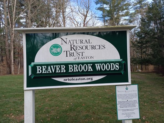 Sign at end of private driveway. The sign says Beaver Brook Management Area. This piece of land consists of about 99 acres that act as drainage for part of Beaver Brook. “Some of the land, which is owned by NRT, continues down to Beaver Dam Road and the stream continues south, eventually emptying into Old Pond. It is claimed the last bear in Easton was shot on Fox Mountain Lot, which is part of this area. The area consists of both swamp and upland and has several access points.” (Easton Conservation Commission) According to Chaffin, in the years after the bear was killed, Fox-Mountain Rock was a popular home to foxes. 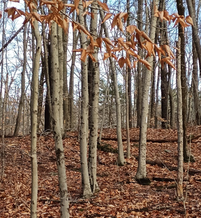 This beech forest is on the Fox Mountain trail which makes uppart of the Bay Circuit Trail as it winds through Easton. What I wasn’t expecting was a stone marker in memory of Pvt. U.S.M.C. Edward F. Smith, an Easton resident killed in the Vietnam War in 1967, at the head of the trail. There was a lovely biography about him encased in a plastic sleeve attached to a tree, which I read, and began my walk in a somber mood, grateful that I was able to be here on this sunny winter day. Of course, Fox Mountain isn’t a mountain, but an area of higher ground; there are many beech trees there, and stone walls. At the beginning of the trail, in two places, were well-built bridges over Beaver Brook, which was flowing quickly. Off to the left of the path was an area of high ground, basically a heap of large rocks or boulders. Climbing up to the highest point, I felt I was quite a bit above the forest floor looking down. This was difficult, though, to capture in a photo. 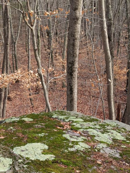 Highest point. Fox-Mountain Rock, I suppose.
I stopped walking at what I believed was the edge of the lot. There was a stone wall and beyond that, the power lines. I turned around and walked back, glad I had finally found Fox Mountain. The trail was clearly marked with white rectangles on trees and the occasional Bay Circuit symbol. *The coordinates that you can use in navigation applications to get to find Fox Mountain Lot are 42.0429268 ,-71.1374247 I stand in awe of the bare trees That in some other lifetime Chose to bind themselves to the soil Knowing what winter was Anne Wooster Drury ehsnewsletter12@gmail.com
0 Comments
Your comment will be posted after it is approved.
Leave a Reply. |
Easton Historical Society and Museum
PO Box 3
80 Mechanic Street
North Easton, MA 02356
Tel: 508-238-7774
eastonmahsmuseum@gmail.com