|
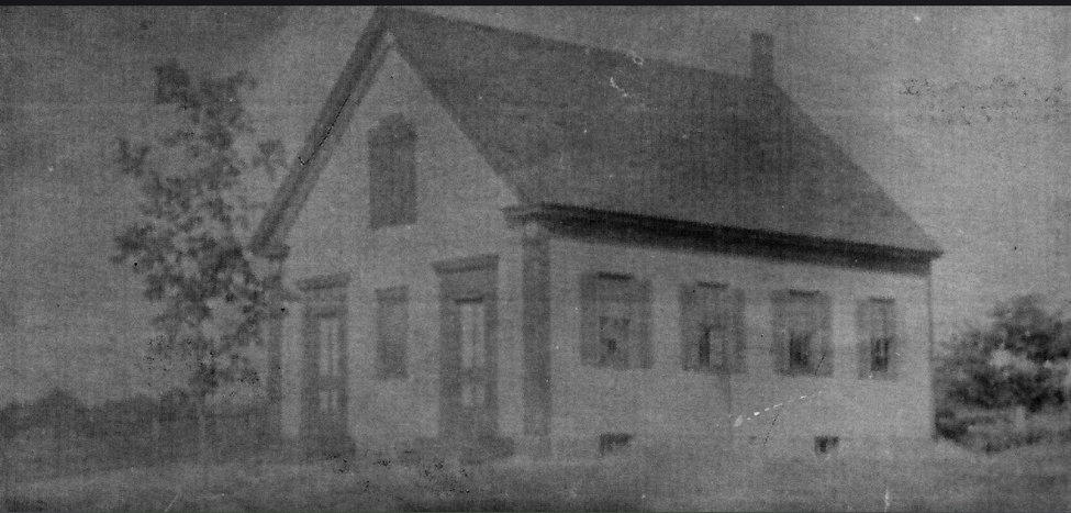
Update on 'Corner Store': Thank you to EHS member and former Easton resident Ed Leonard for this photo of Mrs. Pomeroy's store. Before the Corner Store, Mrs. Pomeroy had a store near the bottom of Columbus Ave. (east end of the street, north side) not far from the present store 'The Peach', which sold bread, milk, candy and some canned vegetables. This was in the 1940's, perhaps into the 1950's. Her house was second below the intersection with Hayward Street with an uphill driveway that she had to walk up to get to her store. It was/is 13 Columbus Ave. Ed grew up at 17 Columbus Ave in the 40's and 50's and remembers it well. Thank you, Ed. The photo shows Mrs. Pomeroy's store in winter with snow on the roof. It juts out beyond the houses and is at the bottom of the street. The dog is Ed's dog Teddy. If anyone remembers Mrs. Pomeroy's store we would be interested to know. This photo was taken in 1947.The trees planted along the street were gifts of the Ames family. Union Villa The Union Villa Restaurant is a landmark in the Unionville section of Easton. I remember sitting in a booth and eating steamer clams when I was in college, and in later years picking up delicious bar pizza for the family. My father liked pepper and onion. Buddy’s Union-Villa, 190 Washington Street. The Villa has a long history; as far back as the 1920’s food has been served at the location. First, John Dyer of Union Street built a permanent ice cream and sandwich shop next door to the Easton Grange Hall on Washington Street, known as Dyer's Homemade Ice Cream and Sandwich Shop. Prior to that Dyer had peddled food door to door in his horse drawn wagon. By 1936 John Spillane and William Flynn opened a restaurant on the same location known as the Union Villa restaurant and Dance Hall. In 1931 John Dyer had a food booth at the Brockton Fair. He was known for his long beard and creative advertising. Washington Street was also known as State Road.
In 1949 the building was known as "Spillane's Union Villa Restaurant, Washington Street, No. Easton, Mass." In 1952, Dyer’s estate sold the entire property to John J. and Elizabeth F. Spillane. After her husband died Elizabeth Spillane, with her son, John J. Spillane, Jr., continued the tradition of the Union Villa Restaurant and Dance Hall. Elizabeth Spillane commuted by bus from Brockton to run the restaurant. In the late 1940's and early 1950's the restaurant was popular with students from the newly created Stonehill College. In 1975, Easton residents, Buddy and Kay Richard, purchased the property and restaurant to operate as Buddy's Union Villa. In 2016 scenes from the movie ‘Stronger’ were filmed in the Villa. The movie was based on a book by the same name written by Boston Marathon survivor Jeff Baumen. Actor Jake Gyllenhaal starred in the movie. Today, Buddy’s five children run the restaurant. It continues to be a popular local bar and pizza restaurant. The following is a quote from Boston's Hidden Restaurants, "The pizza is really something special at Buddy's, however, and its old-fashioned atmosphere is of the type that becomes more and more difficult to find in the Greater Boston area and beyond as the years go by." So go to Buddy's and get yourself some pizza! The dried-up bird’s nest remarks To the gloom in the potato cellar That only the thin green stalks of The briar bushes retain any color Anne Wooster Drury [email protected]
0 Comments
We want to know your thoughts...please complete the survey so we can improve our museum.
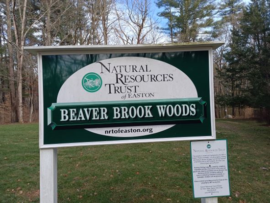
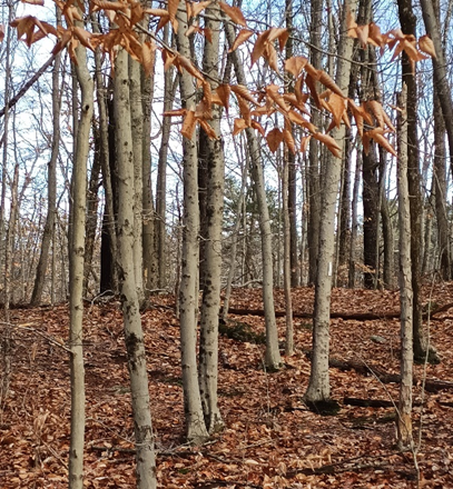
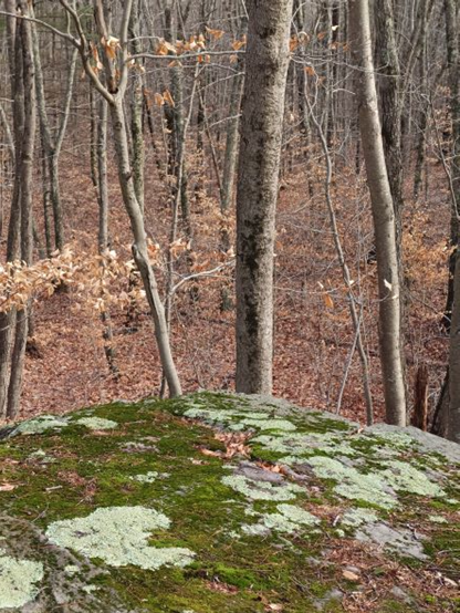
Your ideas and opinions are important to us. Thank you so much! https://qfreeaccountssjc1.az1.qualtrics.com/jfe/form/SV_8doN6wzjQNp5EAm Upcoming: There will be an Open House at the Museum on Sunday February 19, 2023. Fox Mountain Growing up in Easton and having a father who liked to take us on regular walks through the woods, swamps, fields, if off-trail all the better, I’ve been to many natural spots around town, I’ve been lost in cranberry bogs, tangled in briars. But recently a mystery presented itself. I saw a place on a map that I was not aware of and had never been to, Fox Mountain. Fox Mountain is located east of Poquanticut Ave. Relying on my GPS, I set out to find Fox Mountain Lot, as it’s called, and became thoroughly confused. I drove up and down a stretch of Poquanticut many times looking for the entrance. As it turned out, my GPS was just wrong. In talking to my brother, I found out he’d been to Fox Mountain in the past. He led me quite a bit (southeast of Clover Valley Farm) down the road from where my GPS directed. We drove into a driveway connected to a private home and indeed, at the end of the driveway, not easily seen from the road was a Natural Resources Trust sign and nearby a Bay Circuit Trail marker, as this walk is part of the Bay Circuit trail. There was enough room for a few cars to park. Finally! Sign at end of private driveway. The sign says Beaver Brook Management Area. This piece of land consists of about 99 acres that act as drainage for part of Beaver Brook. “Some of the land, which is owned by NRT, continues down to Beaver Dam Road and the stream continues south, eventually emptying into Old Pond. It is claimed the last bear in Easton was shot on Fox Mountain Lot, which is part of this area. The area consists of both swamp and upland and has several access points.” (Easton Conservation Commission) According to Chaffin, in the years after the bear was killed, Fox-Mountain Rock was a popular home to foxes. This beech forest is on the Fox Mountain trail which makes uppart of the Bay Circuit Trail as it winds through Easton. What I wasn’t expecting was a stone marker in memory of Pvt. U.S.M.C. Edward F. Smith, an Easton resident killed in the Vietnam War in 1967, at the head of the trail. There was a lovely biography about him encased in a plastic sleeve attached to a tree, which I read, and began my walk in a somber mood, grateful that I was able to be here on this sunny winter day. Of course, Fox Mountain isn’t a mountain, but an area of higher ground; there are many beech trees there, and stone walls. At the beginning of the trail, in two places, were well-built bridges over Beaver Brook, which was flowing quickly. Off to the left of the path was an area of high ground, basically a heap of large rocks or boulders. Climbing up to the highest point, I felt I was quite a bit above the forest floor looking down. This was difficult, though, to capture in a photo. Highest point. Fox-Mountain Rock, I suppose.
I stopped walking at what I believed was the edge of the lot. There was a stone wall and beyond that, the power lines. I turned around and walked back, glad I had finally found Fox Mountain. The trail was clearly marked with white rectangles on trees and the occasional Bay Circuit symbol. *The coordinates that you can use in navigation applications to get to find Fox Mountain Lot are 42.0429268 ,-71.1374247 I stand in awe of the bare trees That in some other lifetime Chose to bind themselves to the soil Knowing what winter was Anne Wooster Drury [email protected] |
Author
Anne Wooster Drury Archives
June 2024
Categories |
Easton Historical Society and Museum
PO Box 3
80 Mechanic Street
North Easton, MA 02356
Tel: 508-238-7774
[email protected]

