|
Revisiting Uncle Sam When I wrote a short article about Uncle Sam last month for the Summer Quarterly, I did not have the most important piece of information. Our Easton Historical Society Vice President, Jonathan Jackson Coe, is a descendant of Uncle Sam! Edward Wilson Jr. was Jon’s 4th great-grandfather and the brother of Sam Wilson, the Samuel Wilson (1766-1854) who has been officially recognized as the first “Uncle Sam” and the personification of the United States. In 1961 the United States Congress adopted the following resolution:: "Resolved by the Senate and the House of Representatives that the Congress salutes Uncle Sam Wilson of Troy, New York, as the progenitor of America's National symbol of Uncle Sam." Sam Wilson The first Wilson in the New World arrived from Scotland fifteen years after the Pilgrims. He settled in Menotomy- current day Arlington, Massachusetts. His descendants were farmers who stayed in Menotomy, and by young Sam’s time the Wilson family was anti-British and very supportive of the revolutionary movement. As a boy Sam felt strongly about American liberty and according to the biography Uncle Sam, by Thomas I. Gerson & Flora M. Hood, at a young age Sam was a drummer for the Minutemen, and later he ran errands for the Sons of Liberty. He was eventually named an official messenger for the Committee of Safety in Boston and the Committee of Correspondence. In 1775 (Sam was 9) when 14 Redcoats approached Menotomy while on the road to Lexington, Sam was part of a group of older men and boys who fired on the soldiers. Sam killed a Redcoat and the fallen man’s commanding officer surrendered. This was prior to the well-known engagements at Lexington and Concord where 8 Minutemen were killed. During the Battle of Bunker Hill, Sam acted as a lookout from the roof of a building at Harvard College. While Sam’s 2 older brothers fought in the war, Sam continued to serve as a messenger. After the war the Wilson family moved to Mason, NH. Sam was 14. Later, President George Washington was to name Sam’s kinsman, James Wilson, one of the first four Associate Justices to the Supreme Court. In Mason, in 1781, Sam joined the Continental Army where one of his jobs was to slaughter, package, and guard meat. (Meat was often tampered with by enemies.) Later he and his brother Ebenezer left to make their fortune in Troy, NY, where by 1790 they were making bricks. Previously most brick had been imported from England and so was now in much demand. Their business prospered. They also started a meat packing business called E. and S. Wilson Company. Troy was a small but booming outpost and a good fit for a young entrepreneur. In 1797 Sam married Betsey Mann from Mason and they would go on to have four children. Sam Wilson had established himself well and it would be during the War of 1812 that events would conspire to create his patriotic legacy. ……………......................... .....................to be continued.
Anne Wooster Drury [email protected] Don't forget to renew your membership if you have not done so already or join if not currently a member. If you're not sure of your membership status just contact the Easton Historical Society and Museum by email or phone and we will give an update. Beer Beer is a beverage many people enjoy. A hot summer day is a very good time to have a cold beer. Shovel Town Brewery at 50 Oliver Street is a lovely place to experiment with various brews. A particular favorite of mine is called Flyaway, engendering memories (for oldies) of a long ‘disappeared’ pond off Lincoln Street. To keep it all local, some of the hops used in Shovel Town beer are grown at nearby Langwater Farm and the building Shovel Town Brewery occupies was once part of the Ames Shovel Factory. Easton has a history of beer making going back to colonial times. Once hops grew in a field located approximately where the Southeastern Regional School sits on Foundry Street today. An 1871 map shows a “hop kiln” located there. Hop kiln. Source: Easton Historical Society. Hops are the flower of a vining plant. They add flavor to beer, keep it fresher and help it retain its head of foam. Initially beer was imported from Europe, but early on out of necessity, Americans began brewing their own beer. Wheat, barley and hops were the best ingredients, though other foodstuffs like corn, molasses, spruce or boxberry were sometimes used. “Beer– Beer is a good family drink. A handful of hops, to a pailful of water, and a half-pint of molasses, makes good hop beer. Spruce mixed with hops is pleasanter than hops alone. Boxberry, fever-bush, sweet fern, and horseradish make a good and healthy diet-drink……If your family be large, and the beer will be drank rapidly, it may as well remain in the barrel; but if your family be small, fill what bottles you have with it; it keeps better bottled. A raw potato or two, cut up and thrown in, while the ingredients are boiling, is said to make beer spirited.” (The Frugal Housewife, 1835) Easton resident Captain George Washington Hayward, who lived in the Red House at 227 Foundry Street (across from the Southeastern Regional School), made hop growing the chief industry on his farm about the time of the Civil War. The picture above is of his kiln. So, beer-making has a documented history in Easton. If you wish, after pulling weeds in your garden or going for a run on a hot summer day, get yourself a cold beer and enjoy! 1871 map shows a “hop kiln” location Hayward House at 227 Foundry Street (exact date unknown) Anne Wooster Drury [email protected] Links for more information: Hayward - Pool Neighborhood (published in 1993 by EHS&M) Request for Information The Society is looking for memories of Johanna McFadden, a longtime principal at the former North Easton Grammar School. Please send any reminiscences to my email or the Society's [email protected]. Thank you in advance. Easton’s Boundaries Before there were walls there were boundary markers, only sometimes made of something as permanent as stone. William L. Chaffin in his 1886 History of Easton mentions “a little piles of stones” being used to show an early boundary, and in 1713 when there was a boundary dispute over what should be the north line of the Taunton North-Purchase, the boundary was marked by a “heap of stones on a great rock”. Today Easton has 9 known boundary stones indicating its original borders with 8 towns. This is according to an 1899 survey book given to the Easton Historical Society in May of 2018 by a man called William Thomas. The towns are Stoughton, Sharon, Raynham, Brockton, West Bridgewater, Mansfield, Taunton, and Norton. Easton, whose very oldest distances and directions were sometimes described in increments of ‘paces’ taken, now has documented markers. Today the latitude and longitude of each marker is known. According to Joe Pelletier of the Enterprise News “The book, commissioned by the state’s topographical survey commission, was (in a word or two) exhaustively comprehensive.” The book also contains the history of land purchases and legislation that set the borders. The survey was done in 1899 with the technology of that time. The impetus for the survey was that Bay Road had not been well maintained by the Town of Easton and the state required that it be improved. Book Cover Included in the book, called Boundary Lines of Easton, are 9 photographs showing the 9 markers, most of which are granite. Local historians thought these were out there but were not exactly sure where, although a few had inadvertently been stumbled upon. One of the markers is on Bay Road where Easton, Stoughton and Sharon meet. The letters S, E, and S have been carved onto the sides of the marker. It is not far from where Mountain Road meets Bay Road. Another is on private property, one is in the Hockomock Swamp, one is in an industrial park. Photos of markers at the time of 1899 survey. Anne Wooster Drury
[email protected] Links for more information: "History of Easton" by William Chaffin (1975 reprint of the original 1886 addition for sale) Marking History: In Easton, a century-old gift reveals location of original town border markers (Enterprise News article) 1899 Atlas of the boundaries of the town of Easton, Bristol County (Source: Digital Commonwealth) A shout out about an upcoming local event: Local author Lisa Braxton will be at Ames Free Library on June 4th6:30-7:30 pm to talk about her recent memoir About Dancing Between the Raindrops. Lisa Braxton is also the author of The Talking Drum, winner of a 2021 Independent Book Awards Gold Medal and an Emmy-nominated former television journalist, essayist, and short story writer. Her new book is about her personal experience with caretaking and grief. Lisa’s parents died within two years of each other, both of cancer. She herself was diagnosed with breast cancer while caring for her mother. “In this intimate, lyrical memoir-in-essays, Lisa takes us to the core of her loss and extends a lifetime of comfort to anyone who needs to be reminded that in their grief they are not alone.” The event will be held in the 1st Floor Presentation Commons at Queset House. Author Lisa Braxton. On Sunday, May 19, a very successful event was held at the Historical Society & Museum. Lori Pires presented “The History of Hats” to a large audience. Lori has been a collector of hats from a young age and has a sizable collection that she shared with us. Her lively and knowledgeable presentation was informative and entertaining. Lori walked us through the history of hats- work hats, fashionable hats, military hats, ball caps. Lori's daughter accompanied and assisted her. ECAT filmed the presentation if you are interested! “History of Hats by Lorraine.” Presenter Lori Pires. President Ken Michel, always a good sport, introduced Lori. Ken Michel. Hats and a hat box.
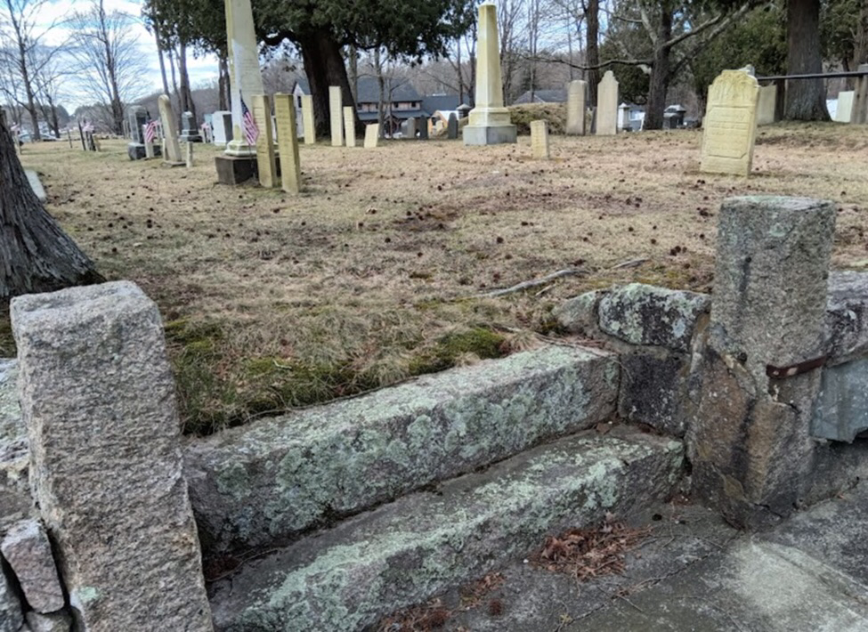
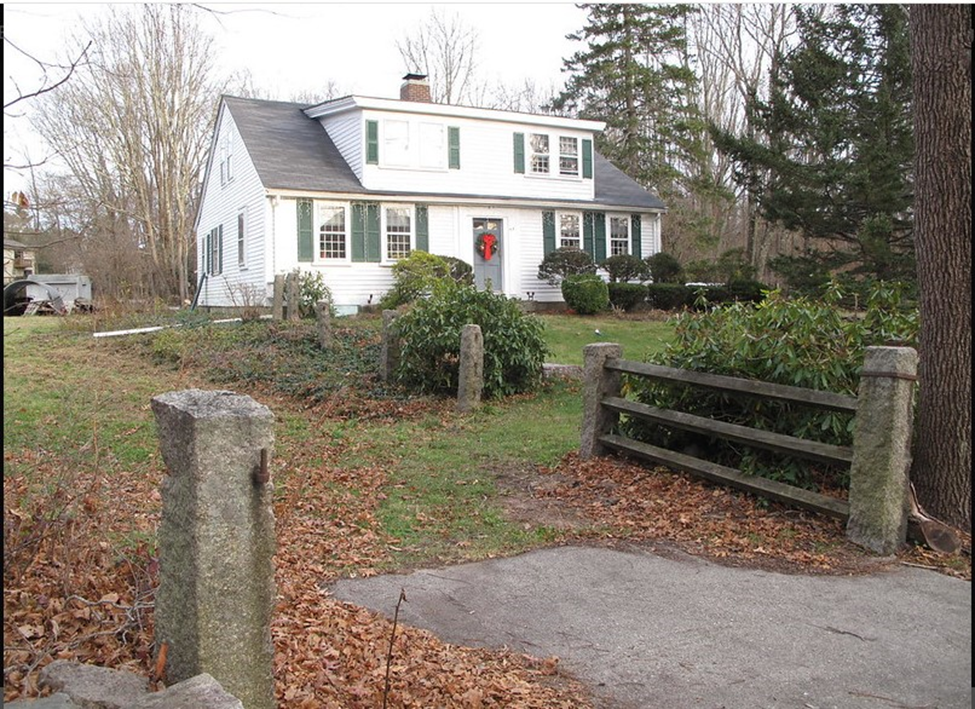
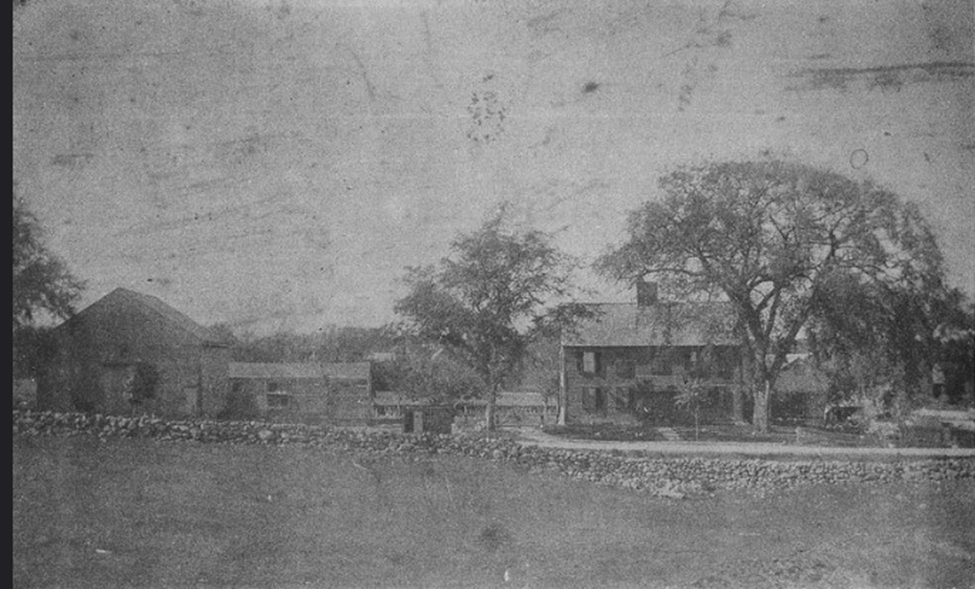
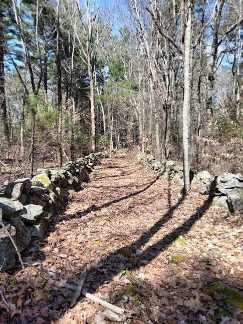
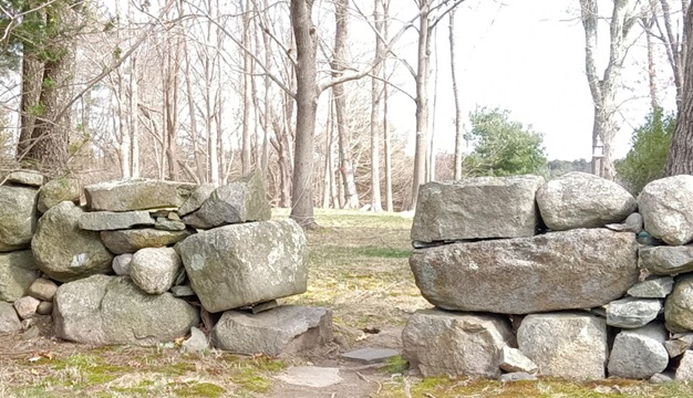
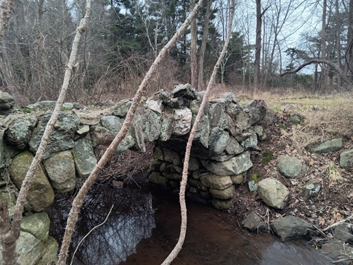
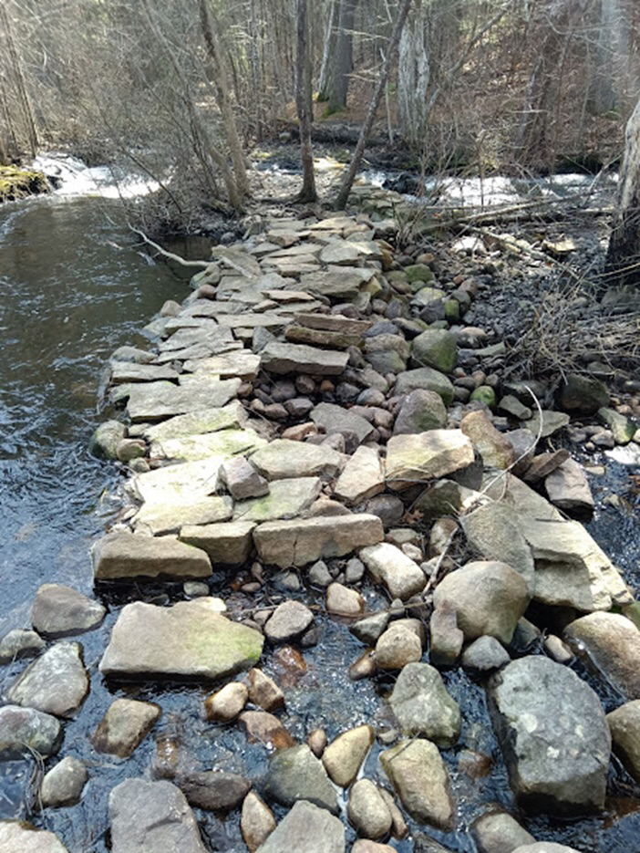
Personally I remember buying a new hat every Easter when I was young; Women and girls still wore hats to church in the 1960's. Enjoy the good weather while we have it and stay tuned for information about upcoming events. Purple iris rim the small pond Yellow iris in fat bud at the big pond Long ago D & K carved initials Into that tree bending under yesterdays STONE WALLS One more time with stone artifacts and I promise I will stop. Often overlooked as important artifacts from the past, stonewalls, and other stone structures, created or edited by man, are a window into the history of New England and its original small farming communities. One of those communities is Easton. Glacial stone is enduring, unlike wood, clay, glass or paper. Here are a few things of interest. A beautiful wall along South Street. A member steered me toward a stone tunnel under the railroad tracks, most likely used for livestock crossing once the train went through. Neighborhood children remember playing in it. This tunnel runs under the railroad line in North Easton. I love this photo from sometime before 1909 when the trolleys stopped running. Five Corners looked very different. Photo EHS. "There is life in a stone. Any stone that sits in a field or lies on a beach takes on the memory of that place. You can feel that stones have witnessed so many things." Quote from Andy Goldsworthy. If this is true and I hope it is, the old stone walls hidden in the woods, the lichen covered ruins in disarray, and the stately boulders of the Rockery must all hold on to memories of our past. Nothing is ever really gone. While some perhaps see the old stone walls and ruins as an unsightly nuisance, many love them for what they represent. They speak of our communal past- in New England, and here in Easton in particular. Today many street names still reflect Easton’s rural past- Randall Farm Drive, Andrews Farm Road, Deer Meadow, Beaver Dam, Scotch Dam Road, Sawmill Lane, Cranberry Lane, Olde Farm Road. Perhaps we are nostalgic for the past. Some stone walls in New England have been re-purposed for other projects. While this may be practical in some cases, we should also remember that the walls are artifacts from the past and as such are a precious window into our common history. So, while you’re enjoying a walk in the woods or a stroll along Easton’s streets, keep an eye out for these beautiful reminders of our agricultural past. From 1895: Around 469 Bay Road looking south.
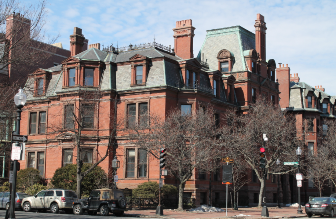
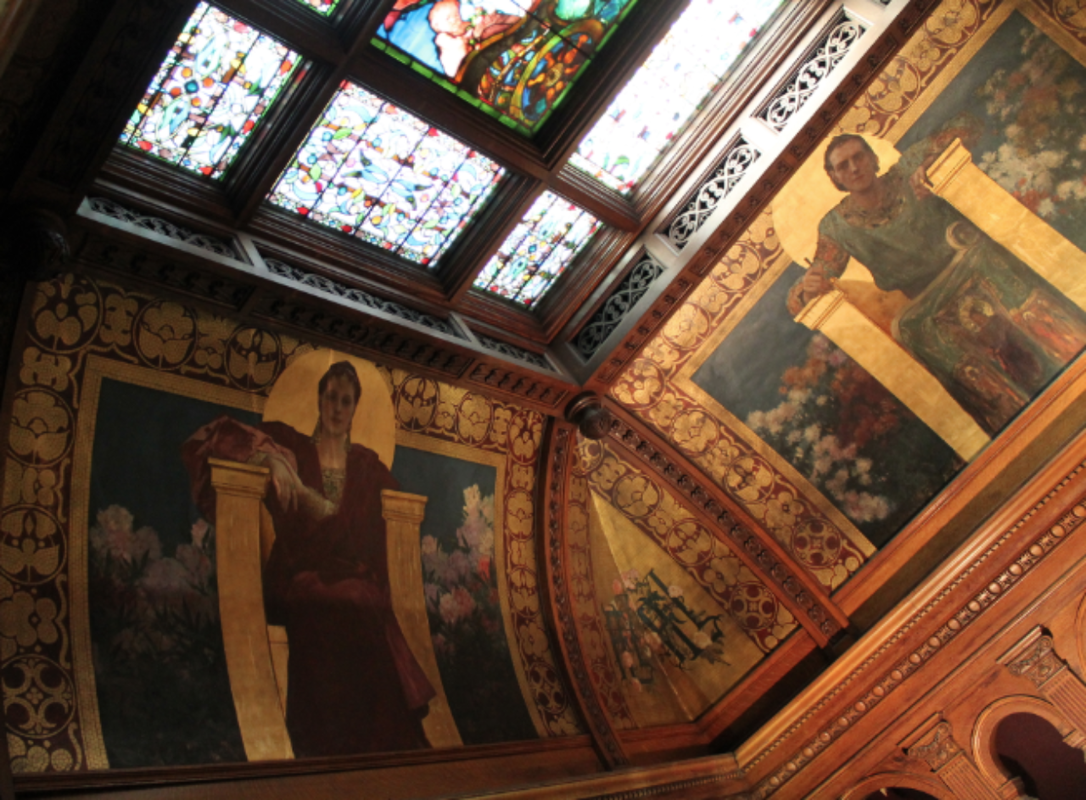
Ames-Webster Mansion The Ames-Webster Mansion is located at the corner of Commonwealth Ave and Dartmouth Street in Boston's prestigious Back Bay neighborhood. In the 1880's it was the winter home of industrialist and congressman Frederick L. Ames, "who engaged the finest craftsmen and artists to create a true architectural masterpiece and Gilded Age icon." (Campionre) Mr. Ames's family/country home was located at Langwater in North Easton. The original mansion was designed in 1872 by architects Peabody and Stearns. In 1882 the home was enlarged for Mr. Ames by architect John Hubbard Sturgis who also designed the Museum of Fine Arts. In the house were 50 rooms, 28 fireplaces and various hidden passageways. The beautiful home was inhabited by the Ames and Webster families for ninety years. Inside are masterful works of art including stained glass by John LaFarge and murals by Benjamin Constant. In 1972 the mansion was converted to serve as offices and was used as such until 2014 when the building was bought by Dr. Fahad El Athel, who began restoration. Under the supervision of the architectural firm Hamady Architects the stained glass and murals were cleaned and restored. A reinstatement of its original gated carriage entrance and a new garden were added. The old Ames-Webster building was now a three-unit condo building with parking in the basement and common spaces that are true to the history of the space. "Heir to railroad fortune, Mr. Ames served as vice president of the Old Colony Railroad and Fall River Steamboat Line. He was also an art collector, with holdings that included porcelains, paintings, crystals and jades, according to a New York Times Obituary in 1893. The Ameses were entertainers and would host grand parties in the oak great hall, with the orchestra playing above in the music room, according to Mr. Hamady's research. Mr. Hamady found old photographs of Mr. Ames dressed up as a Shakespearean character at a costume party, most likely Henry VIII." (Wall Street Journal) Thus another interesting connection to North Easton and the illustrious Ames family. Anne Wooster Drury [email protected] Sources and more information:
|
Author
Anne Wooster Drury Archives
June 2024
Categories |
Easton Historical Society and Museum
PO Box 3
80 Mechanic Street
North Easton, MA 02356
Tel: 508-238-7774
[email protected]


